Thirteen days. Twelve states. Six national parks. Two important monuments. Three state parks. 5,330.2 miles. 2,832 photos. Zero tire flats. Seven nights camping in tents. One glorious lightning-loaded rainstorm. One night spent sleeping in a car. One lovely evening at a farm with friends. Four happy family members. Countless memories.
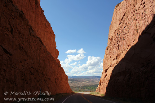 We just returned from our 2012 summer vacation, in which the boys and I left Austin and headed west to Utah, north to Grand Teton and Yellowstone (where Michael joined us via airplane), east to the Badlands, south to our friends’ farm in Kansas, and then all the way home again. It was our longest road trip to date. Combine that with our trip to the Everglades in the spring, and we have really managed to tour a big chunk of the United States in this year alone!
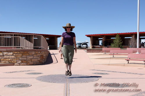
Jumping over Colorado, Utah, Arizona, and New Mexico at the Four Corners Monument
Our first primary destination was the area of Bryce Canyon National Park in southern Utah. But we took a slight detour along the way so that we could stand at the Navajo Nation’s Four Corners Monument, where Colorado, Utah, Arizona, and New Mexico meet. I decided that jumping over four states at once seemed better than just standing there. Yes, in fact, I am a goddess.
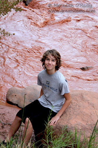
The Fremont River flows red when summer rains wash red silt from the surrounding landscape.
From there, we emerged ourselves fully in the grand beauty that is southern Utah. Just when you get used to one spectacular mountainous view, you drive around a curve and suddenly everything looks completely different, as seen in the top photo of this post.
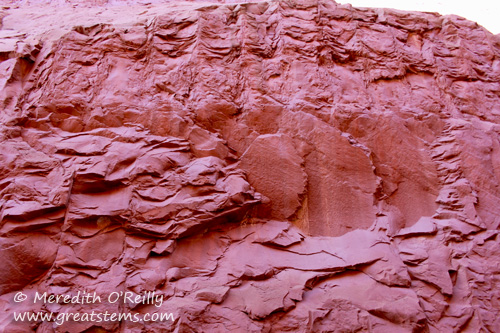
There’s a reason why this area of Utah is called red rock country.
Our first night in Utah, we camped at Escalante Petrified Forest State Park. It’s a relatively small but scenic state park located along Scenic Byway 12. There’s a lake near the campground, but it’s decidedly swim-at-your-own-risk, and not for the usual reasons. When we arrived at the park, the ranger handed us a detailed info sheet about something that sounded appalling — an aquatic parasite that causes something called swimmer’s itch. It turns out that this parasite is in Escalante’s Wide Hollow reservoir as well as in some of the other lakes in Utah state parks during the summer. No, thank you — we’ll just hike, we said. And hike we did.
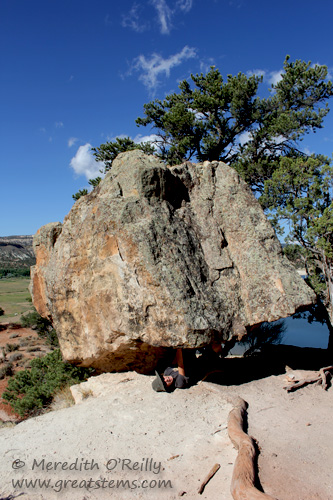
Balanced Rock at Escalante Petrified Forest State Park
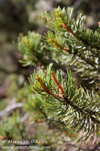
Pine at Escalante Petrified Forest SP
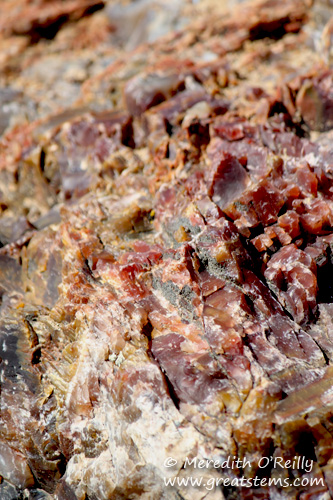
Petrified wood at Escalante
The park is named for colorful petrified wood logs and thousands of petrified wood bits located within the hiking area.
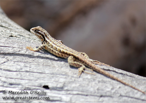 But we were just as enthralled with the many skinks and other lizards we saw as we walked along the trails. In fact, we got a little competitive about it, seeing who could find the most lizards, some worth two points if they were less common than others. Snakes were worth 15 points, but alas we didn’t find any.
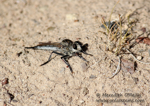
Robber fly
Interesting wildlife like robber flies had their own category.
From Escalante Petrified Forest State Park, we headed west along Scenic Byway 12 to Bryce Canyon National Park. Our first taste of Bryce began with Mossy Cave, a short hike at an area within Bryce Canyon National Park but well before you arrive at the visitor center and park entrance.
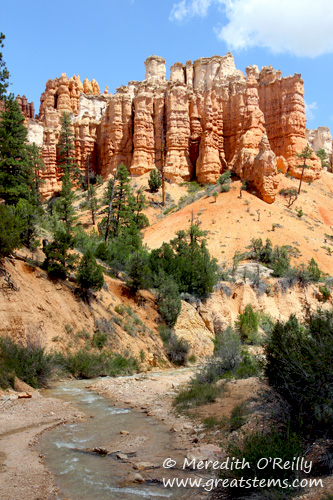
View at Mossy Cave trail, Bryce Canyon, UT
Here one can already see the hoodoos for which Bryce is known, and which I’ll explain about shortly, and a scenic waterfall, stream, and small cave add additional beauty.
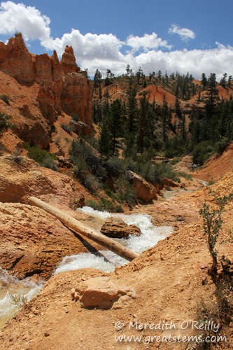
View from above the waterfall at Mossy Cave, Bryce Canyon, UT
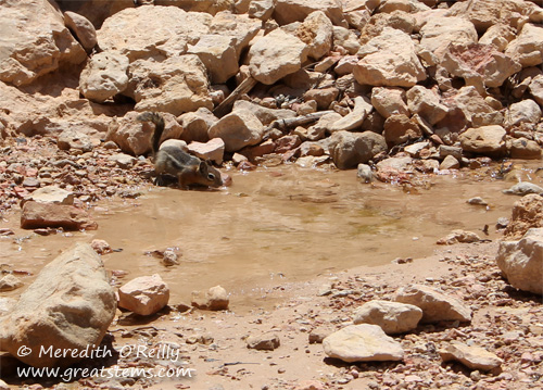
Golden-mantled ground squirrel getting a quick drink
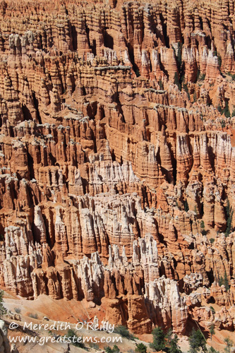
Bryce Canyon National Park really has to be seen in person to be believed. It’s unlike any place I’ve ever traveled. It’s not a true canyon, where a flowing river shapes the landscape. Instead, ice and rainwater have eroded away limestone and other rock to form vast amphitheaters of tall heavy-topped spires called hoodoos.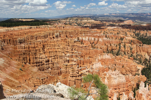
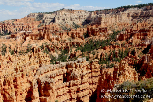
There are many different scenic viewpoints accessible via a driving tour or by hiking along the rim, and other trails take you down below the rim.
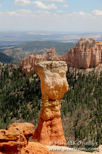
A hoodoo, a tall limestone-topped spire formed by erosion
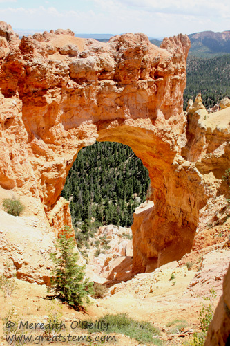
An arch at Bryce Canyon, though its name is Natural Bridge
I fell in love with Bryce. How could one not?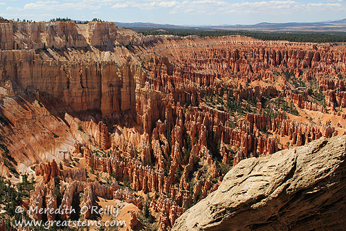
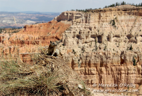
A Golden-mantled ground squirrel on one of the points of Bryce Canyon, UT
We saw birds and many a squirrel at Bryce. Surprisingly, we didn’t see a single lizard, compared to the dozens we’d counted at Escalante Petrified Forest just a few miles away.
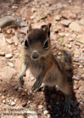
This young squirrel came looking for food, but when we didn’t offer anything, it moved away quickly.
At Sunset Point, we took a trail down below the rim, one called Navajo Loop.
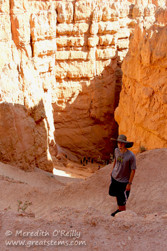
Navajo Loop, Bryce Canyon
Look into the depths, and you’ll get an idea of the downward trek.
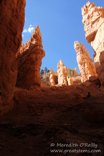
View from the bottom of the rim at Bryce Canyon’s Sunset Point
It was worth it.
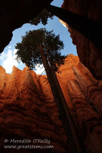
A tree grows tall in a sunlit nook of the Navajo Loop at Bryce.
Trees appear in sunlit spots within the narrow canyon, and before you know it…
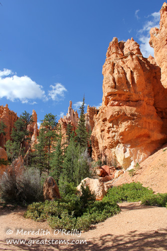 it opens out to a much bigger and colorful scene, where the trail continues.
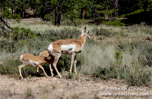
Pronghorns
As we were leaving, we saw this pronghorn family slowly crossing the road, a park ranger protecting them from moving cars. The young fawns nursed the whole way.
From beautiful Bryce, we headed toward Zion, camping overnight before starting the next day’s adventure.
I really enjoyed reading about your trip and seeing your stunning photos. Like your family, we do a lot of driving trips across the U.S. to national parks, but this is one we’ve not seen yet. We really must get out there.
Pam, I highly recommend it. Just going through these photos makes me realize which places I’d like to explore more. Bryce — actually all of Utah’s red rock country — is definitely one of them.
Can’t believe you didn’t make a small – maybe 600 miles or so extension and drop by and visit me in southern Oregon. Currently I live in a two bedroom house – but the second bedroom is only for campers – no furniture.
But hopefully you will head my way and most places I stay let me have company.
Your pictures were fantastic.
Oh, Marilyn, how I want to. But we’re planning a full West Coast journey in a year or two and we’re trying to hold out until then. I promise to let you know if I can make a surprise trip, though!
Meredith you traveled in some of the most beautiful and unusual areas of our country. I am looking forward to seeing the beauty through your eyes. Just amazing!
Donna, I think the boys really saw our country at its finest. They’d been west to Arizona and Colorado before, but this was the U.S. in a whole new light.
Bryce is my favorite rock park we took that route in ’08…are you all continuing West? The photos are beautiful…love that robber fly, it looks vicious. Can’t wait to hear more about it!
Cheryl, we’re actually home now. I’m going through all the photos now, one post at a time. Zion report is next!
Pingback: Westward Bound: Hiking the Narrows at Zion National Park | Great Stems
Awesome photos – no really – they’re awesome.
I went to Bryce Canyon as a kid. I don’t remember much, but I do remember my sister and I convinced our parents to go hike to the bottom of it, and then obviously back out. We had 2 canteens of water between the 4 of us. Smarts – we have them.
Katina, I bet you’ll bring more water on the next visit!
Pingback: Westward Bound: Wyoming, South Dakota, Kansas | Great Stems
Your photos are always so beautiful. If I can’t go along, they’re the next best thing. Just amazing!
Thank you, Vicki. I hope you’ll have an opportunity to visit those places soon, too!