Having left Grand Teton National Park on our 2012 summer vacation, we headed the short distance up the road to the well-known Yellowstone National Park for the next leg of our adventure. And just like that, we entered a world completely different from the Teton area. For all the words and pictures you might see about Yellowstone, use it as incentive to get yourself there, for nothing can do this amazing place justice other than the place itself.
If you get caught up in the dramatic scenery and wildlife of Yellowstone and forget that you are sitting on a big volcano, Yellowstone takes care to remind you of this at every turn. Today’s post will highlight Yellowstone’s hydrothermal features, and the next post will take a look at the wilder side of Yellowstone.
 Yellowstone is home to some 10,000 hydrothermal features. Aside from hundreds of geysers, the national park also has hot springs, mudpots, and fumaroles, or steam vents. These first images show one of my favorite hot spots, so to speak — Grand Prismatic Spring.
Grand Prismatic Spring is located in the Midway Geyser Basin at Yellowstone. Its rainbow-reminiscent colors are due to different types of microscopic thermophiles — bacteria, archaea, algae, and others — that tolerate specific temperature ranges of hot water. The deep center of the spring, reaching 121 feet down, is a vivid blue, its extremely hot temperature of 188 degrees F (87 degrees C) keeping species of thermophiles from taking hold. From there, as the water moves outward to the surface, the water cools, and thermophiles that thrive in specific temperatures begin to create communities. From the deep blue, colors transition to greens and yellows (167F/75C), then to oranges, rusts, and reds, and finally browns in the coolest temperatures (around 90F). Where the cooler water flows over the surrounding landscape, thriving bacteria and archaea create colorful orange, red, and brown mats .

Bacteria mats are fascinating, and you’ll see more pictures throughout this post, for I consider them to show some of nature’s finest artistry. That thermophiles can survive in such extreme heat seems surprising, and it’s one reason they weren’t discovered until the late 1960s (in Yellowstone, in fact). Additionally, some thermophiles need acidic conditions, others alkaline, and some require the presence of sulphur or calcium carbonate. Up to dozens of thermophile species can be present in any given community, depending on their requirements and/or limitations.

If you hike up a steep slope off the nearby Fairy Falls trail, you can get a unique view of Grand Prismatic Spring. We now refer this area as Pant-Ripper Mountain. And that’s enough of that story.
 However, I will say that my pants earned their very own Yellowstone patch.

Though Grand Prismatic Spring might have been my personal favorite hydrothermal feature at Yellowstone, the best known features are likely the geysers, especially (say it with me) Old Faithful. We arrived in the early morning to see it, and we enjoyed a crowd-free view of this classic eruption. Old Faithful reaches 135 feet or more in height and erupts every 90 minutes or so. The park rangers actually use a formula to predict the expected time of the eruption, plus or minus 10 minutes.

Though Old Faithful might be the most famous, it is actually just one of many geysers in the Upper Geyser Basin area. In fact, the majority of the world’s active geysers are found here, including five predictable ones. Trails and boardwalks take you along Geyser Hill and beyond, where you can observe many thermal features in action. The Anemone geyser in the foreground of this Old Faithful image bubbled for us right up until Old Faithful erupted. We just had bad luck, however — its eruptions are not connected to the big guy. Anemone actually erupts to about 6 feet every 7 to 10 minutes.
 We did have great luck to be near the Beehive geyser just as it was getting ready to erupt. First, the indicator vent let loose, prompting folks to gather around for the big event to come. Some of them pulled out rain ponchos, too — clearly they knew something….
 A few minutes later, Beehive let loose in a thrilling display. Its powerful water column can reach heights up to 200 feet. Because it is close to the boardwalk, water droplets will sometimes drench the crowds in temporary rain, which fortunately is remarkably cool by the time it comes down. Again, we had luck — the wind shifted to our left just as Beehive erupted, soaking other visitors but not us and most importantly not our cameras. And by the way, I really do mean soaking for those other poor folks.
 Another lucky moment for us was being on hand for the eruption of the grand geyser that is cleverly known as Grand Geyser. It also can reach 200 feet, and its display is as impressive as its name implies.
 The walking trail takes you past numerous other hydrothermal features, some with impressive sinter formations. Siliceous sinter comes from deposits of silica dissolved by hot water passing through rock called rhyolite. Above, you can see a thin sinter crust around Heart Spring. The deep blue color of the hot spring indicates that this water is super hot, so hot that even Yellowstone’s heat-loving algae and bacteria can’t survive.
Another example of a deep blue hot spring at Yellowstone is the Abyss Pool, which is located in the West Thumb Geyser Basin. Its depths reach 53 feet. This pool was once described in 1883 as “a great, pure, sparkling sapphire rippling with heat.”
 The West Thumb Geyser Basin, by the way, overlooks the large, blue Yellowstone Lake, and many hydrothermal features can be found right along the edge of the lake, as well as IN the lake.
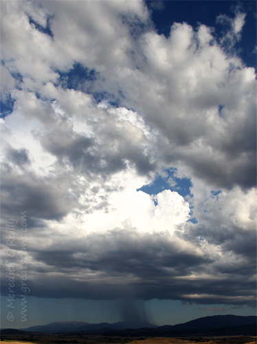
 Why do all these hydrothermal features exist at Yellowstone? Simply stated, Yellowstone is on top of a large volcano. This supervolcano erupted 2.1 million, 1.3 million, and 640,000 years ago, forming three overlapping calderas, or geographic depressions. The last major eruption formed the Yellowstone caldera that would one day become the bulk of park we know and love. The Yellowstone caldera sits on top a giant hotspot. Magma flows as close as 2-5 miles below the surface, releasing tremendous heat. Water from snow and rain fills the underground plumbing and gets heated, sometimes to super temperatures of 400 degrees Fahrenheit when pressurized. It is this heating of water, combined with many small earthquakes and other natural processes affecting underground channels, that give Yellowstone its dynamic, impressive, and quite numerous hydrothermal features. The above photo shows that some of these changes can occur in the most unexpected places.

This image shows the sinter at the base of the Great Fountain Geyser, located in the Fountain Paint Pot Area. Though we didn’t get to see the geyser erupt, the steam and sinter were so beautiful and unique that I wasn’t the least bit disappointed. Apparently a sunset eruption is truly worth seeing if your timing is right, however.

The change to the landscape as a result of the presence of hydrothermal activity is quite eye-catching, and I love the contrast it makes with surrounding creeks, rivers, blue sky, and green trees and other plants.

Perhaps the best example of altered landscape is at Mammoth Hot Springs, a unique area at Yellowstone due to the dominant rock being limestone instead of rhyolite.

 Here, dissolved calcium carbonate from hot water rising through the limestone is deposited in the form of travertine.

Such rock forms the massive terraces found at Mammoth Hot Springs, developing slowly over many, many thousands of years..
 But I found some of the prettiest artistry when I looked down for a closer look, where thermophiles and mineral deposits create tapestries of colors and shapes.

Whether this formation is a bacterial or mineral formation, that it follows the shape of the fallen pine tree piece is fascinating beyond words.

This bacterial mat at Black Sand Basin, back near Old Faithful, might not be beautiful in everyone’s eyes, but if you think about the variety of microscopic communities this mat shows, you just have to be amazed. Thermophile communities can form ribbons or streamers, columns, and wide-spreading mats of varying colors, and any seemingly endless combinations and appearances therein.

If you’re not crazy about the bacterial mat so vibrant at Black Sand Basin, just turn around and get this view instead of Cliff Geyser.

Of course, Yellowstone has its ever-fun mudpots making their “bloop-bloop” sounds, and one should always be prepared to smell the sulfur-related rotten egg smells wherever thermal features with hydrogren sulfide exist. To truly appreciate both, visit the Mud Volcano Trail. The hydrothermal features in this area are some of the most acidic in the park, some with a pH of 1, which is comparable to battery acid. There’s plenty of rotten-egg smell to delight the senses, as well!

Norris Geyser Basin is another highly acidic area and holds some of the park’s hottest hydrothermal features, many of which can reach temperatures above the boiling point (200 degrees Fahrenheit at Yellowstone’s elevation). Because it sits at the intersection of three faults that happen to also meet on an active volcano, changes occur at Norris Geyser Basin every year — new thermal features appear while others go dormant, or they exhibit behavioral changes. The above photo shows the view from the overlook at Porcelain Basin, which is in the Norris Geyser Basin area. The large amount of steam on the left is coming from the Black Growler Steam Vent, a fumarole.
 How do plants and wildlife thrive around all these intensely hot, alkaline or acidic, and ever-volatile features? Well, many birds like the young Killdeer above enjoy flies that feast upon thermophilic bacteria at the edge of hot springs. This Killdeer walks along brown thermophilic mats, which indicates the temperature is around 90-100 degrees Fahrenheit. Hot yes, but okay for a bird to walk along.
 This American bison had us worried when we saw it laying down on Geyser Hill near Old Faithful, but it was still breathing — we checked (from afar). It turns out he’s an older Bison, and perhaps the warm geyser area made a good sleeping spot. He got up and wandered away after a few minutes. But quite often we would spot Bison scat and other droppings in hydrothermal areas. It’s important to recognize that there is still danger here — a Bison or Elk walking too close to the fragile crust near a geyser or hot spring could suffer a traumatic death.
 Many plants thrive despite their warm-water surroundings. The Bison scat mentioned above actually has great effects on the landscape surrounding hydrothermal areas. The seed- and nutrient-rich droppings of Bison and Elk allow grasses to grow where once there was none.
 But other plants succumb to the effects created by the presence of heat, silica, or pH. A change in hot water flow can suddenly kill off old-growth pines. Geysers spray silica-rich waters, which can flow around nearby pine trees. This will eventually kill the trees because they will effectively drink up this water, drawing silica into their roots and trunks, which will harden over time until the plants die. But where some plants no longer live, other areas will support new growth. Nature continues.
Here are a few other images of Yellowstone’s hydrothermal features worth sharing:

Emerald Pool at Black Sand Basin

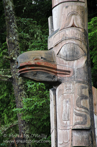
Dragon’s Mouth Spring along the Mud Volcano Trail — the Crow once imagined the steam as snorts from an angry bison
Clepsydra Geyser, a nearly constant performer

The famous Morning Glory Pool, no longer at its finest due to years of people throwing coins and other trash into it until water circulation became greatly diminished.
In the next post, I’ll take a look at the wilder side of Yellowstone — the rivers and trees and wildflowers and animals that make this national park one of the most beautiful natural habitats still in existence.


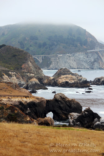
 We drove past Stockton, then cut over to the coast, coming out right at Monterrey. We would be camping down at Big Sur, but since we were ahead of schedule we stopped in to enjoy this historic and beautiful town.
 The Monterrey Peninsula is known for its beautiful scenery and wonderful wildlife. The coastal waters are home to harbor seals, sea otters, visiting whales, and many, many birds.
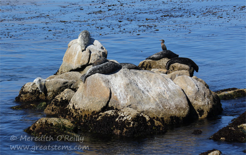 It always amazes me that harbor seals can flop themselves up onto such high rocks.
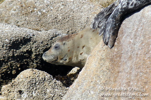 This little one was well camouflaged among the rocks — one had to look closely to see it (compare to photo above).
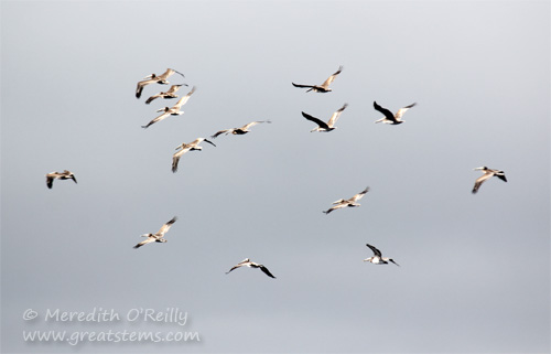 When you are pelican-obsessed like I am, it’s remarkably better to have a digital camera in your hand than a film camera. Brown pelicans always seem to be in migration when I visit California, and I love watching them fly by. Usually they are in a long line as they fly, but this group got a little wild and crazy.
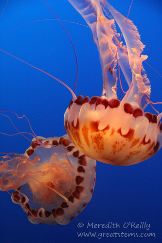 At the Monterrey Bay Aquarium, we oohed and aahed over marine life such as Purple-striped Jellyfish.
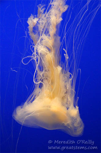 This is an equally beautiful Egg Yolk Jellyfish.
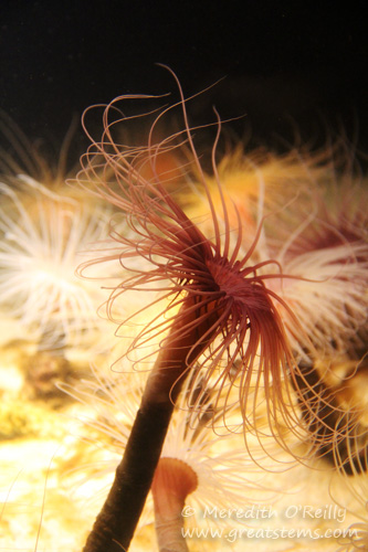 Likewise, a tube anemone. I have to admit, Monterrey Bay Aquarium really is a good one, especially for families.
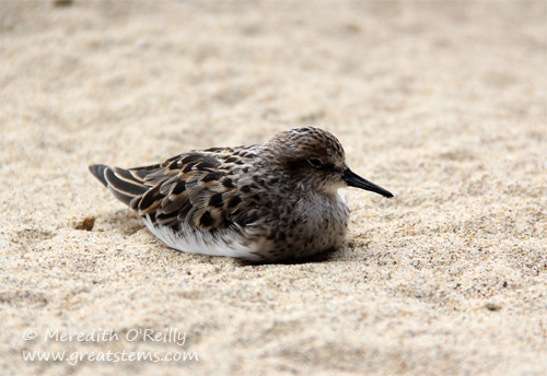
 As our true destination was Big Sur, we headed down the beautiful Highway 1. As is always our luck, the fog rolled in just in time for our drive.
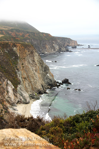
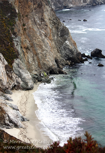
 But no worries, we loved it just the same.
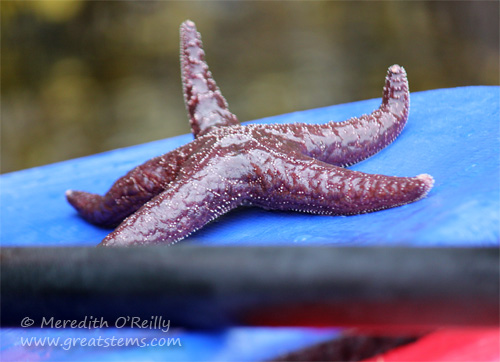 The water was surprisingly clear, too, and that meant we could see sea stars, jellyfish, and other marine life pretty well. Above is a Purple Ochre Sea Star, a keystone species. It helps encourage marine life diversity by controlling populations of the Common Mussel.
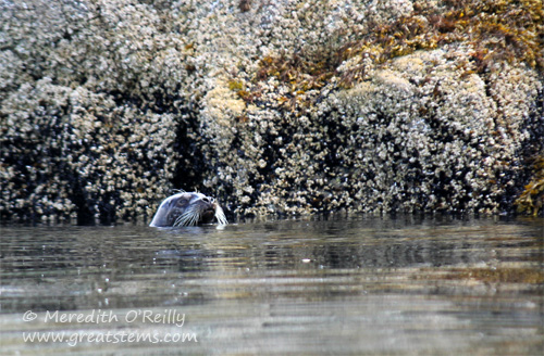
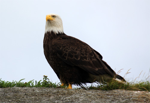 A bald eagle stood watch from a rock near one of the Tatoosh Islands.
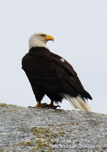 It truly is a majestic bird and quite big — an adult can weigh up to 14 pounds.
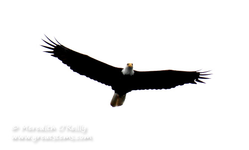
 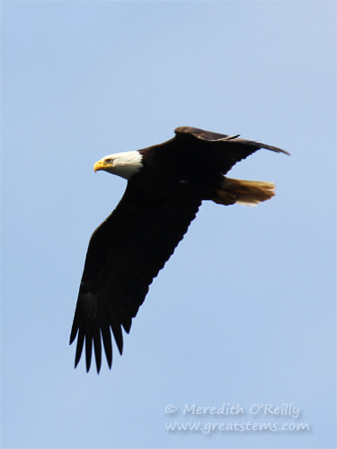 Bald eagles are stubborn birds. If they catch a fish too heavy to fly with, rather than drop it they’ll swim along awkwardly with their wings serving as paddles.
  Our final cruise stop was Victoria, British Columbia — a brief visit to Canada. I’d heard how beautiful this city is, but I’ll have to visit another time to truly see it. Our families voted to go look for killer whales, and so it was back to the ocean for us again.
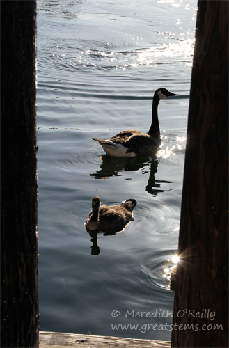
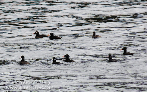
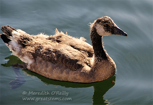 While boarding the tour boat, these Canada Geese swam over for a hello. It was nice getting to see Canada Geese while actually in Canada.
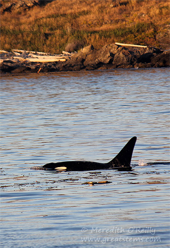
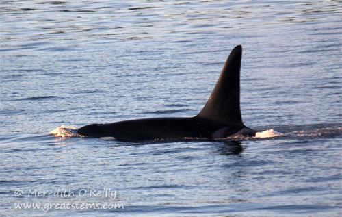
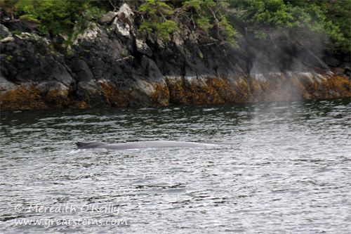
 We watched a small family of resident orcas. They were very focused on foraging for fish in the kelp-heavy waters.
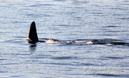
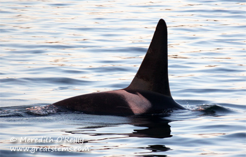 The killer whales were remarkably calm in their approach to getting food — swimming at easy speeds and occasionally curving into a deeper dive.
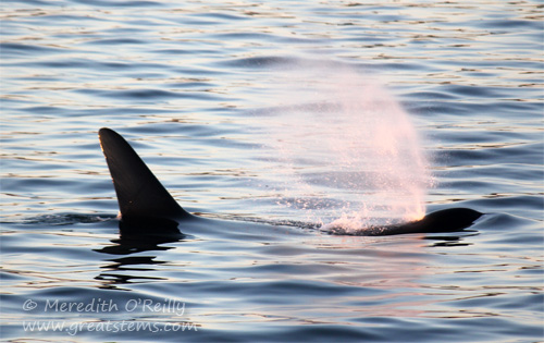
 Who would have thought watching killer whales would prove to be a relaxing activity?
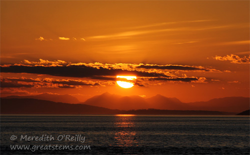
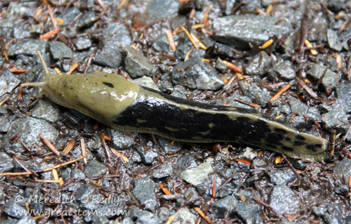 Thanks to the morning rain, large banana slugs found easy passage across the paths. Their slow pace make them pleasant photo subjects. This one was about 6 inches long.

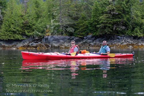
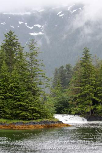
 Taking a boat in Sitka Sound, we enjoyed plentiful wildlife, and by this time the rain had ceased completely. Above is a friendly, well-known humpback whale named Domino.
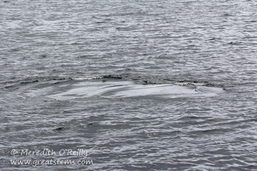 Here’s what is known as a whale footprint, a slick spot that forms as a whale thrusts its fluke up and down underwater.
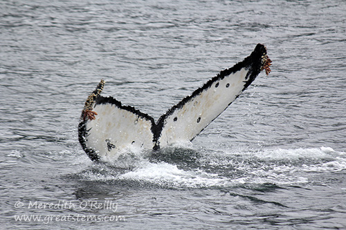 Not only does Domino have distinct black spots on his fluke, the growth of barnacles at the tips is an additional identification mark for this handsome whale.
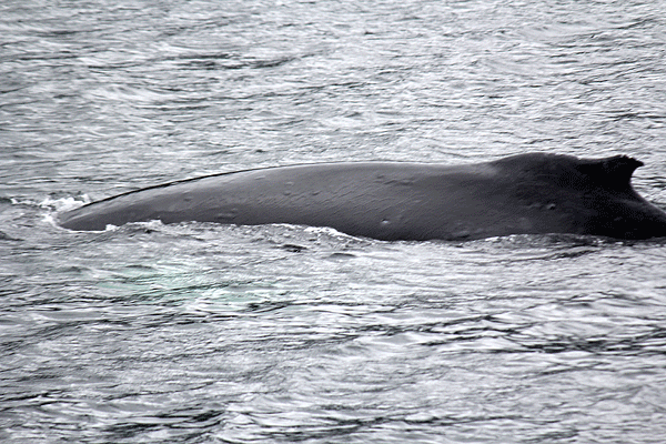
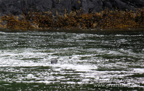
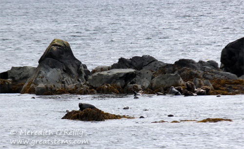 Near these tiny islands, mere rock outcrops, a large group of harbor seals basked, played, and fed.
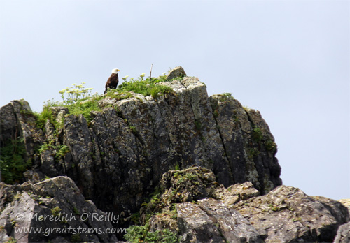
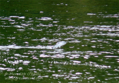
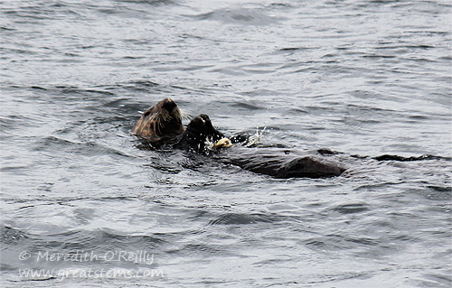 I can probably safely say, however, that despite the large variety of wildlife we saw in Sitka, our family enjoyed the sea otters most of all (though for some reason that harbor seal going after the jumping salmon still stays on my mind).
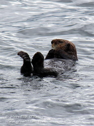
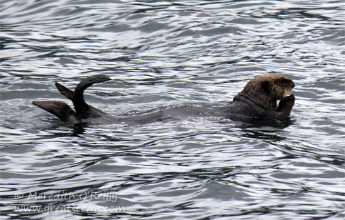 They’d roll and preen and dive and eat, and they’d preen some more.
 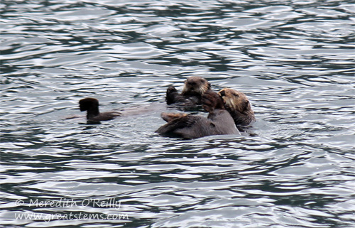 I’m so happy their numbers have been going up — they were hunted almost to extinction by fur traders. Sea otters are still listed as endangered, however. Sea otters are a keynote species, keeping the population of sea urchins and other kelp-eaters under control and thus protecting the habitat that provides shelter and food for so many other marine animals.
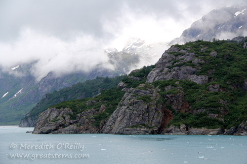
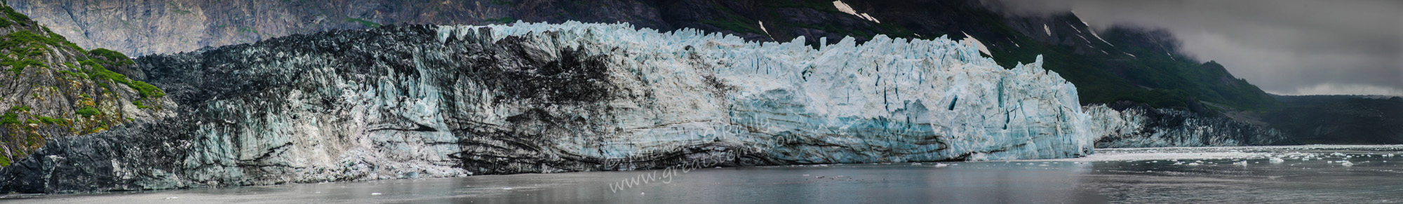
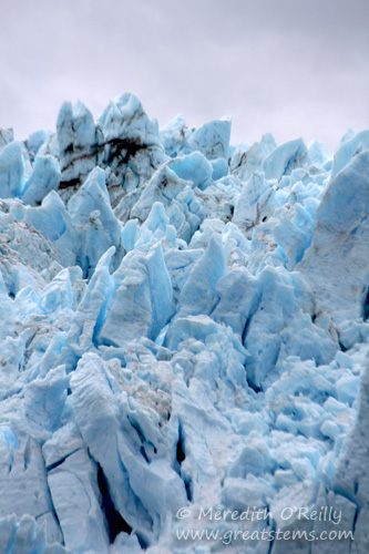
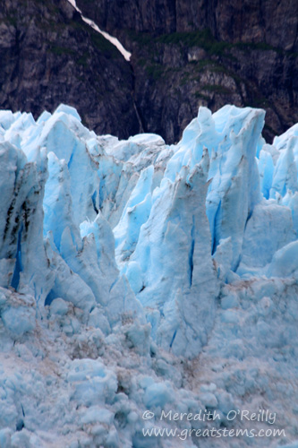
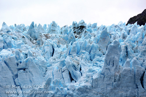
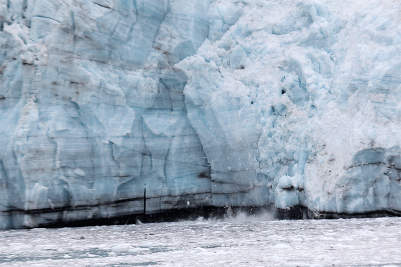
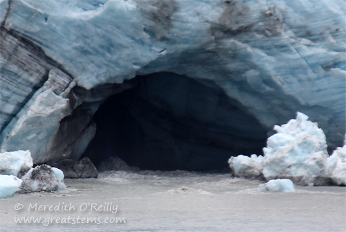
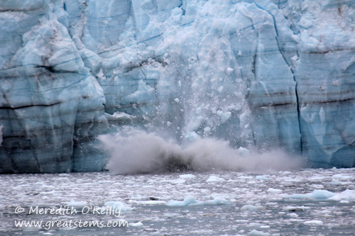 Calving is the sudden breaking away of ice from a glacier, forming icebergs and the like. Margerie Glacier calves actively all year long. Sometimes, falling ice might simply be small chunks, and by that I mean ones the size of Volkswagon Beetles or school buses.
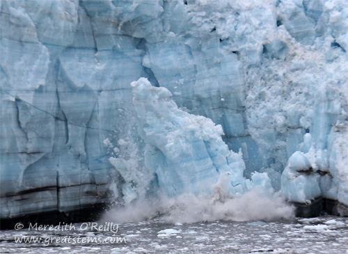
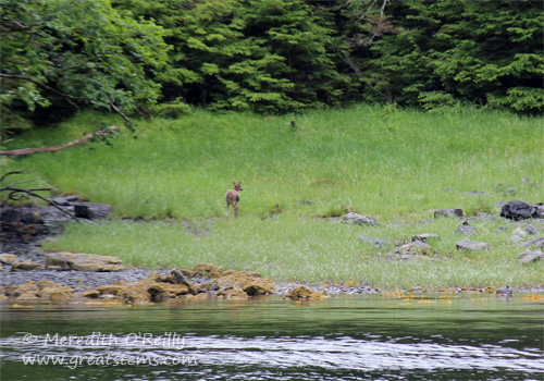
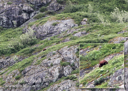 As we headed to other glaciers, we spotted this Grizzly Bear walking up a hill. From the ship, it was a mere dot and almost impossible to see without a zoom lens or binoculars.
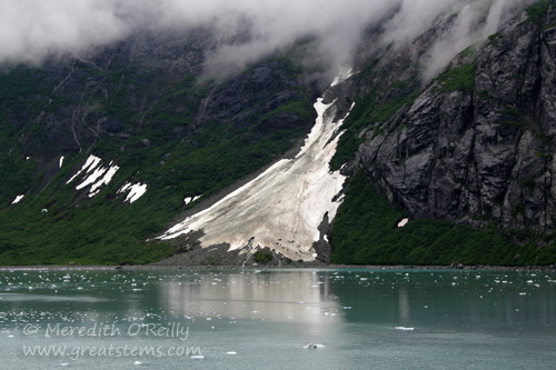
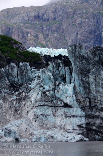
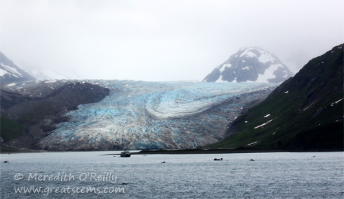
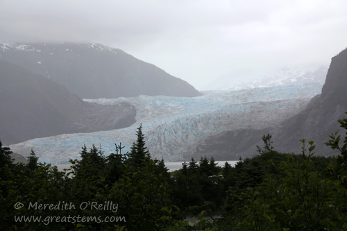
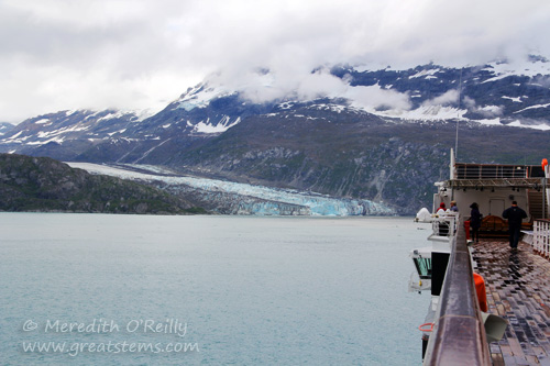 Lamplugh Glacier, 8-miles long and about 3/4-mile wide, is another glacier in the West Arm of the bay.
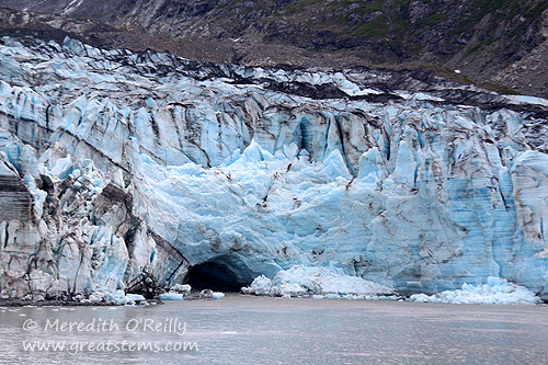
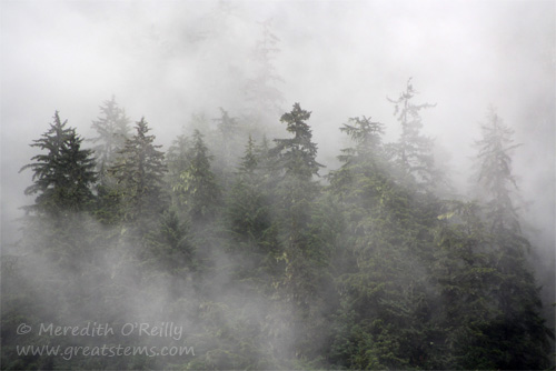 In fact, fog became the norm for our vacation, so much so that it became downright amusing. But that’s to be expected of the Pacific Coast in July.
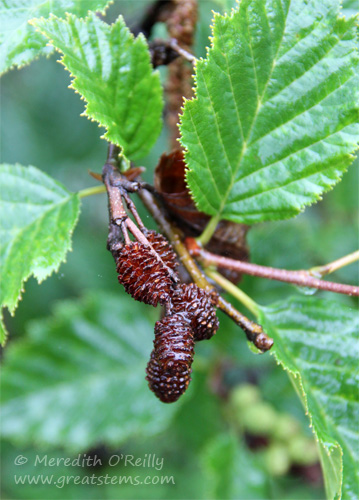
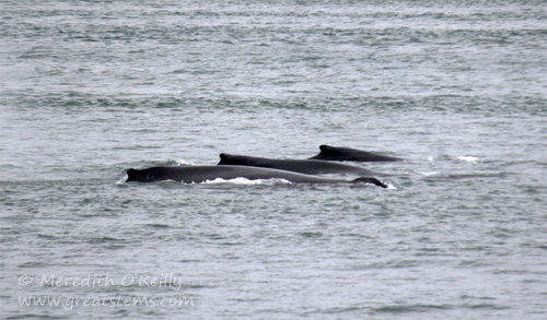 The real cold and wet fun came when we went whale watching in Auke Bay. Several humpback whales were in sight. These three stayed close together, feeding and taking breaths in near sync.
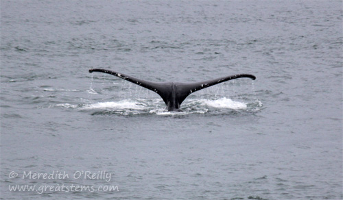
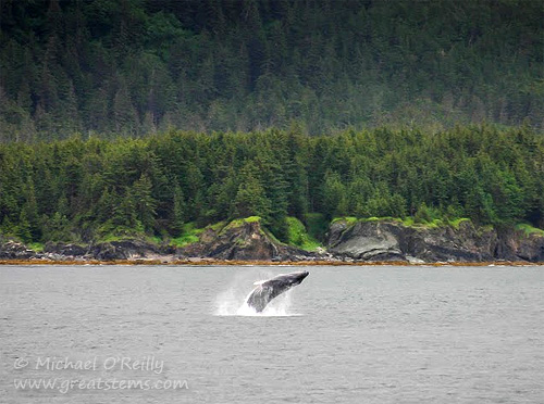 Across the bay, a solitary humpback breached several times. Oh how we wished our boat had been closer!
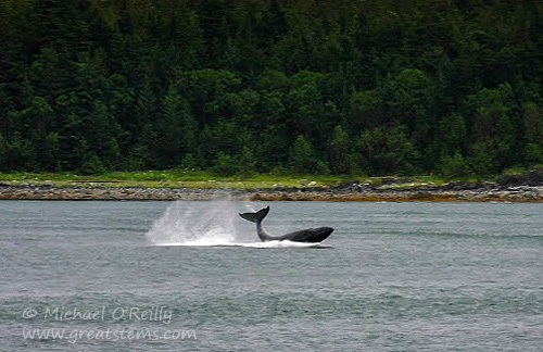 Even across the bay, the sight was thrilling.
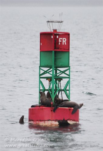


 We kept to the driving plan, intending to reach South Dakota that very day, so we only paused now and again to take in the peaceful surroundings. We did stop briefly for lunch in Cody, Wyoming, and even ate at the Irma, the hotel and saloon made famous by Buffalo Bill. (As nice as that might sound, I’ll warn you that the food and service were quite a disappointment. At least the historic atmosphere was something to offer the boys.)
 Custer State Park maintains a population of about 1,300 Bison.


 This big male is wallowing in the dirt. While many bison will do this to when biting flies bother them or when they are molting, in rut season male bulls do this to both leave their scent and display their dominance.

 For example, prairie dogs are the primary food source for the endangered black-footed ferret, once thought to be extinct after prairie dog populations greatly declined, a result of habitat loss, extreme control methods, and disease. Burrowing Owls and Mountain Plovers build their nests in prairie dog burrows. Additionally, prairie dogs’ burrowing and grazing habitats improve soil quality, nutrient cycling, plant and animal diversity, soil water retention, and other ecosystem processes. Plus, prairie dogs kiss each other in greeting, and that’s just too cute.


 Even so, we redid this photo several times, because Logan’s head kept blocking out the Grand Teton (not that we were surprised). We finally got one showing Grand Teton, but then Nolan’s head got cut out of the picture. Alas.


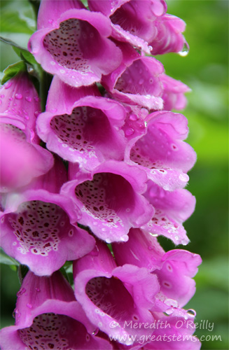
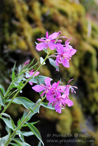
 Grand Teton National Park in summer still has many beautiful wildflowers, such as Indian Paintbrush.


